Looking closer at Reedy Creek

img_0735

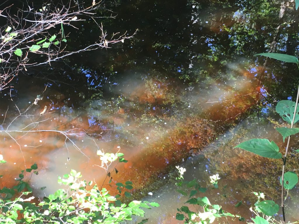
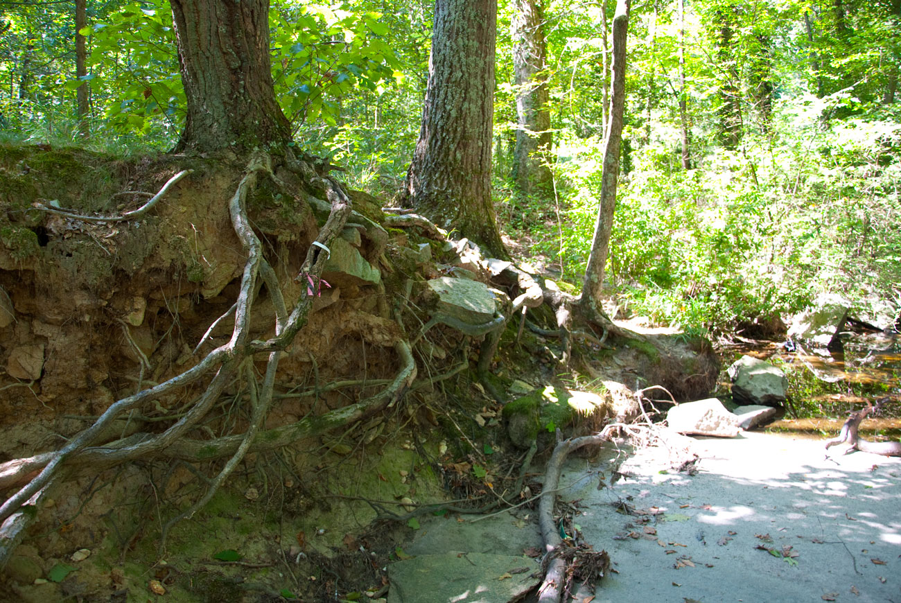
Last week we made a second group trip to Reedy Creek. It was the perfect early autumn day to explore Forest Hill Park. I found this section of the creek much more enchanting than the section we saw last month. Undoubtedly the city feels the need to keep up appearances in the park, and that shapes and skews our experience of nature. The interesting thing about Reedy Creek is how different it feels at each section. Upstream, the creek is contained within a concrete channel, giving it a distinctly utilitarian feel as it serves to drain water into the James River—it’s like a glorified drain pie. Further downstream it feels more wild, and inside Forest Hill Park it becomes a destination for the community.

As we walked along the creek and approached a concrete footbridge, Laura mentioned playing a game of “Pooh Sticks,” referencing A.A. Milne’s Winnie-the-Pooh. Standing on a bridge over flowing water, two people lean over and drop twigs into the water before rushing to the other side of the bridge to see whose stick traveled fastest. I hadn’t heard of the game until my wife Sally Ann introduced me to it on one of my first visits to her hometown. At the center of Aiken, South Carolina is Hitchcock Woods, a park that easily conjures imagery of the Hundred Acre Wood from Milne’s books. We reenacted her memories of reading Winnie-the-Pooh and playing Pooh Sticks in the woods.

Recently I’ve been reading Martin Heidegger’s The Will to Power as Art, and I see a connection to the ideas we’ve been exploring with this project. He writes about the nuanced Greek philosophical ideas of physis and techne. Physis is the natural world, anything that comes into being and fades away all on its own, specifically without human interference. Techne is simplistically understood as the term for craft or art, but more broadly it means human intervention on nature, “that knowledge which supports and conducts every human irruption into the midst of beings … the kind of knowledge that guides and grounds confrontation with and mastery over beings, in which new and other beings are expressly produced and generated in addition to and on the basis of the beings that have already come to be (physis). This push and pull between physis and techne informs broader ideas about the Anthropocene Epoch, and more specifically, my thoughts on the Reedy Creek project.

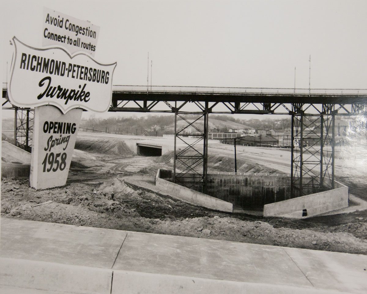
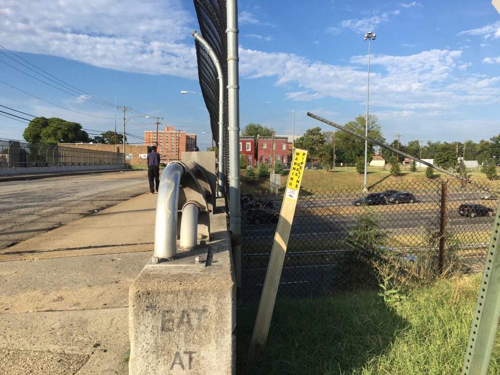
The Reedy Creek situation is a microcosm of the larger push and pull between human development and the natural world. In my project, I am looking specifically at suburban development and its inherent paradox—we want to live alongside nature, but we alter and destroy it to make that possible. Instead of accommodating nature, we end up remediating it. The result is dislocation and fragmentation.

physis-techne-screen

I am exploring ways to visualize this fragmentation and the tension between physis and techne. My first step was creating a simple illustration of the community around Reedy Creek, incorporating a few iconic pieces of suburban development. The area around the creek is more typical of older suburban development, but a few key markers are there—grids of single family homes with yards, cul-de-sacs, and parking lots along the commercial strips. The creek is represented in its form as a concrete channel and in its most natural form downstream. Referencing the old-school game of sliding numbers, I began playing with the deconstructed forms in physical space. This led me to explore the idea as a screen-based interactive experience. I like the possibilities afforded by the web, but this feels more like a single piece that needs the framework of a larger installation.

The Suburban Idyll

Late 19th century American cities were centers of commerce and industry, and dense populations inhabited urban cores both small and large. Urban populations faced public health issues and social problems both real and perceived. Richmond was no different. Advances in transportation technology prompted the burgeoning American middle class to leave central cities and establish the first wave of commuter suburbs. (Richmond claims the first practical streetcar system in the world.) A certain romanticism of the idyllic English pastoral landscape influenced the construction of detached single-family houses, each with self-contained yards and gardens. The hope of the first upwardly mobile suburbanites was that life on the outskirts would be an escape from disease and social ills in-town, a retreat into the health and beauty of the natural world.

Contractors, speculators, and landscape architects sought to celebrate an idealized version of the natural world, introducing non-native plants intentionally and unintentionally, growing grass lawns low in biodiversity, and later spreading fertilizers and pesticides in order to keep up appearances. They crafted a new version of the natural world to suit their needs and fulfill the dreams of the new middle class. Further outside of town, these first streetcar suburbs would later be encircled by a new kind of development enabled by the automobile—houses in subdivisions on cul-de-sacs, strip malls,  and superhighways—what we now call suburbia. The irony is that by shaping and manipulating the natural world over the past century, we have altered the landscape to the point of destroying those initial dreams of life lived alongside nature.

Humans have sought to contain nature, shaping it and distorting it at our convenience and for our pleasure. We have literally moved mountains and streams. In Richmond, the issues facing Reedy Creek and the community around it are directly related to these concurrent Anthropocene histories of industrialization, urban planning, architecture, politics, and social sciences.

A few Reedy Creek ideas

img_0406_frog_web

Last week we had a great visit to Reedy Creek. We learned more about the issues and flaws in the city’s restoration plan. As I begin to think about how to respond as a designer, I am contemplating several questions. The problems facing the Reedy Creek are vast and multilayered. Which part do I want to focus on? How do I want to approach it. Is it about advocacy? Is it educational? How can a simple idea have the widest impact?

Eroded banks and exposed roots are a common site along Reedy Creek. Storm water builds up velocity in a concrete channel upstream, and the force of it wreaks havoc downstream.
Eroded banks and exposed roots are a common sight along Reedy Creek. Storm water builds up velocity in a concrete channel upstream, and the force of it wreaks havoc downstream. The sudden rush of water during storms also impact biodiversity along this part of the creek.

One of the key themes about the Reedy Creek situation that stuck out to me was the need to educate the public more about the issues surrounding the restoration plan and the environmental impact that each property contributes to the bigger problems. Grass lawns are the most common feature for private properties surrounding the creek, and as we learned, runoff from these yards, especially during storms, contributes to erosion in the creek and an over-saturation of nutrients in the water as a result of the use of fertilizers and other chemicals. Another related issue is the lack of biodiversity in the creek and on private lawns in the watershed—we learned that grass lawns are deserts in terms of biodiversity. Over the past few centuries, we’ve tried to craft the landscape to fit a certain idyll of manicured beauty more suited to eighteenth century pastoral England. Both deliberately and unintentionally we’ve also introduced invasive species that have gradually choked off numerous important native species. Maybe my project is about educating private citizens in the watershed about native species and taking steps to revive native flora and fauna in their yards. The effect would be multifold—increasing biodiversity, capturing water that would otherwise flow into the creek, and limiting the amount of nutrient buildup in the water.

Urban renewal / buried history: a visual investigation

Last week I shared the backstory of my investigation into the Jackson Ward community and the destruction that occurred there during the construction of I-95. All of that research informed my process for making an object of design. With this piece, I seek to give new form to buried and forgotten history, telling the story of the destruction and fragmentation of Jackson Ward.

urban-renewal-buried-history-fragmented-community
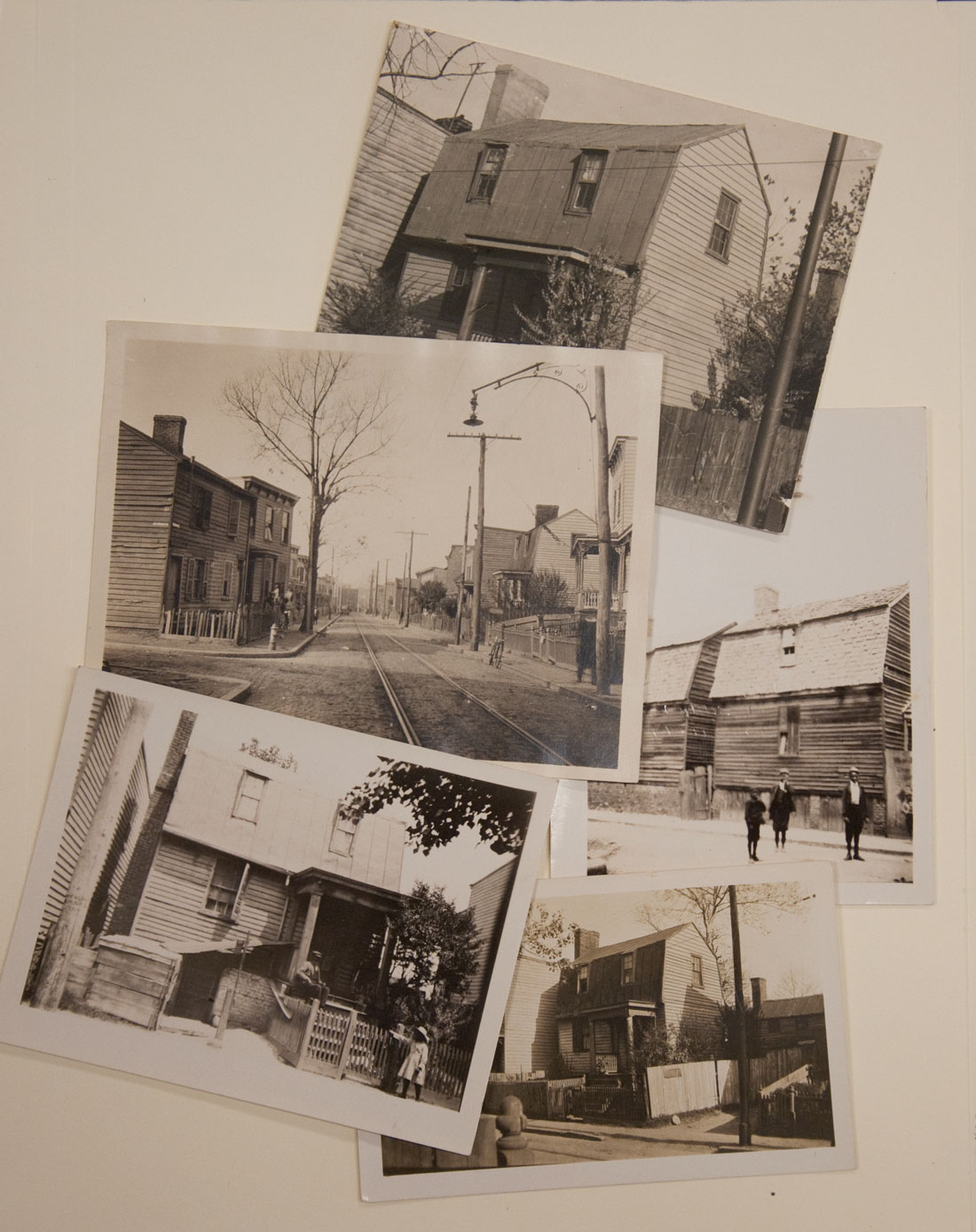
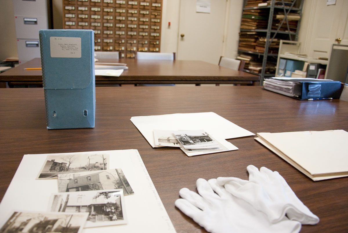
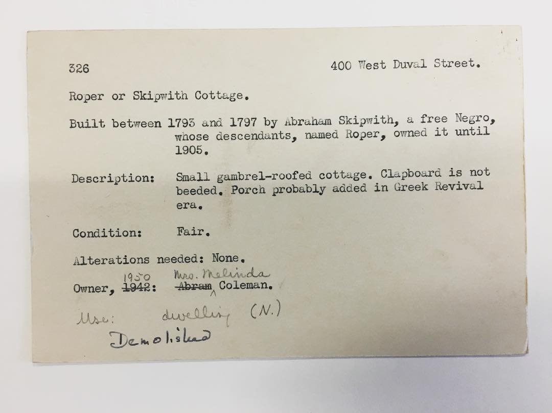
The architectural form of the Skipwith-Roper Cottage and the story attached to it become symbolic of the larger issues in the neighborhood after the disruption of the highway. A simplified gambrel-roofed cottage crafted in clear acrylic holds sleeves with layered imagery, iconography, and text. The piece functions as a condensed visual archive of primary source materials and as a narrative timeline. It is ghostly and clear, with all of its interior contents exposed and out in the open. The clarity of the sleeves changes depending on how they are viewed—from the side, the layered images obscure each other in a dissonant mass of texture, with details coming into focus only on closer look. Moving around to a three-quarter view yields more resolution. The sleeves are also movable, an interactive experience alluding to the act of doing archival research.

I encountered several challenges and had a few new experiences while making this piece. I used a laser cutter for the first time, and I kept thinking about the intro sequence for Stranger Things. This part of the process was so fun! The laser cutter also helped me avoid trying to cut the acrylic by hand, which would have been difficult, if not impossible to do cleanly.

A video posted by Drew Sisk (@drewsisk) on

Before cutting the acrylic, I built a model of the structure using chipboard to get a feel for the form. This helped me determine the best course of action for gluing the acrylic pieces together. I learned quickly that acrylic cement is messy, but it got better as I went along. The next challenge was choosing the content for each sleeve, an exercise in editing. How literal should the story be? I had a wealth of archival imagery and text and on-site documentation to choose from. Ultimately I chose five pieces of content: a map of the neighborhood with the cottage labeled “Roper” from the 1870s (from the Library of Congress archives), several local newspaper clippings on slum clearance and a neighborhood resistance movement in the decade before demolition, a promotional sign for the highway (manipulated from a photo at the Valentine), a simplified overhead view  of the Belvedere/I-95 cloverleaf interchange, and a photograph taken from an overpass over the highway during my field research.

During critique I received lots of valuable feedback and points to consider going forward. A few good questions and suggestions are below:

“Does it need a signifier? Where is this specific cottage in all this. We might need more info.”

“Maybe it’s a small dot of color that runs throughout on each of the sleeves.”

“Could this become a site-specific installation?”

“Consider scale and materials. Could it be larger? Made of wood and glass? What about its construction—what if the sliding pieces were horizontal drawers instead of vertical sleeves?”

“Execution gets in the way. The glue splotches are distracting.”

All of this feedback is great, and I do hope to push this piece further. I consider this a first iteration of the concept, with room to experiment on a larger scale piece. I also want to document my research, maybe with a short handmade book.

Initial thoughts on Reedy Creek

After familiarizing myself with the issues surrounding the Reedy Creek restoration plan and the opposition movement against it, I want to take time to outline a few of the key points as I understand them now. After a first reading, some of the issues are nuanced, but I am leaning toward opposition to the project.

The US Environmental Protection Agency initiated a plan several years ago called the Chesapeake Bay Total Maximum Daily Load (TMDL), an effort to clean up the bay from pollutants and restore the rivers and streams throughout the eight-state watershed area. Local government entities are held responsible for executing plans to clean up streams and creeks falling within their respective jurisdictions. One of the City of Richmond’s initiatives is to restore a section of Reedy Creek, to “mitigate flooding, prevent stream bank erosion, improve in-stream water quality, and to strengthen the city’s stormwater infrastructure.” It sounds good on the surface—everyone should get behind a project to improve the environment, right? Turns out it’s more complicated than that.

One issue is clear—we are constantly finding ourselves in situations in which we need to repair human-made systems that have failed us, sometimes on a colossal level. This is a concrete example of life during the Anthropocene Epoch. Years of pollutants and chemicals in the form of runoff from industrial sites and stormwater drainage laden with toxic fertilizers from lawns have flowed into streams and rivers, which in turn have badly polluted the Chesapeake Bay. The way we built infrastructure in the past has also created huge problems for us that have compounded over time. In an effort to contain flooding decades ago, the City of Richmond built a concrete containment device for part of Reedy Creek. The way I understand it, if you think of the concrete channel as a larger version of a drain pipe, the water pressure coming out downstream is high and concentrated, leading to erosion and other issues on the other end of the creek. Everyone seems to agree that we have a mess on our hands, but opinions differ greatly on the plans to fix the issues.

The Reedy Creek Coalition is a group of community members with a compelling argument against the restoration project. Their main point of contention is that the city’s plan only addresses the symptoms and not the causes of the problems. Symptoms include erosion and unclean water, but they argue the larger problems are the lack of a more comprehensive plan, poor choice of location for the restoration work, and lack of education with the public regarding their own contributions to the problem and, in turn, their potential involvement in solutions. They acknowledge that the project might actually help the Chesapeake Bay in the short term, but the effects on the local environment would be disastrous. (This sounds eerily similar to issues I’m investigating with the interstate highway system—it alleviated automobile congestion and made inter-city travel easier, but it left community destruction in its wake. It actually disrupted the communities it connected.)

This is a systemic issue. RCC asserts that we need to talk about solutions for system-wide issues rather than respond to surface-level issues that create the biggest short-term political splash. It’s the same as a legislature saying we need to build more lanes on the highway to alleviate congestion, when the issues are the flaws in the larger systems of urban planning and transit. It’s easy for governments to appeal to the public with immediate solutions—”we will clean up the water now, we will improve traffic congestion now, we will stop panhandling now, we will improve school performance now, we will reduce crime now“—but it takes more effort and deeper engagement to work toward systemic change.


Jackson Ward: Displacement and Buried History

400-duval-street_animation

In the 1950s, the United States launched one of its largest comprehensive infrastructure projects ever, the construction of the national interstate highway system. The primary goals of this web of limited access roads was to facilitate faster automobile trips between cities and states and to ease congestion for commuters traveling daily to central business districts from the growing suburban and exurban communities. While it succeeded in moving people to and through America’s cities, it had disastrous effects on the country’s urban cores.

Construction of the Richmond-Petersburg Turnpike. Image courtesy of the Valentine

An interest in the disruption caused by the construction of the interstate highway system led me to a deeper visual investigation of the Jackson Ward community in Richmond. This neighborhood, known at one point as the “Harlem of the South,” was the center of African American culture in the region. The community was literally split in half by the construction of the Richmond-Petersburg turnpike (I-95) in the 1950s. A block-wide swath was cut into the cityscape, leaving scars of destruction that still remain unhealed. Hundreds of historic homes and neighborhood structures were cleared for the sake of America’s burgeoning car culture.

1st Street overpass, Jackson Ward

My first field research included a trip to the area around 1st Street and Duval Street. This area directly abuts the south side of the highway. In these images, you can see the stark interruption of old neighborhood density disrupted by interstate highway. Blocks of old rowhouses are pocked by abandoned buildings and vacant lots. Looking across the overpass, you can see the public housing complex built originally to house poor families who lost their homes during demolition and construction of the highway, part of a decades-long national effort tinged with issues of race and inequality—slum clearance and urban renewal.

The next step in my investigation was to overlay maps from before the highway construction with contemporary maps, to observe the changes to the streetscape and infrastructure over time, block by block. As expected, the changes to the street grid alone were tremendous, with many streets and alleys completely disappearing. A cloverleaf of entrance and exit ramps, emblematic of our postwar automobile culture, disrupted several blocks all by itself. These pieces of information had nuance and intrigue, but I needed to dig further to find a specific narrative to focus on as a designer.

Along with examining maps collected from the Library of Congress online archives, I found two books that helped me get a sense of some particular issues in Jackson Ward. The Jackson Ward Historic District (1978), by Robert P. Winthrop and Houses of Old Richmond (1941), by Mary Wingfield Scott both held accounts of a cottage that once stood at 400 West Duval Street on the western edge of Jackson Ward. The house was built by Abraham Skipwith in 1793–1797. I was shocked to read that Skipwith was a freed slave, living in the antebellum South; somehow I was unaware that there was a community of emancipated African Americans living below the Mason-Dixon line decades before the start of the Civil War and the Emancipation Proclamation. The house would remain in the family for generations, later becoming known as the Skipwith-Roper cottage after Abraham Skipwith’s granddaughter married Peter Roper. These layers of history formed data points to be used in mapping a narrative.

Skipwith-Roper Cottage and Duval Street in Jackson Ward. Images courtesy the Valentine.

Winthrop acknowledged that the Skipwith-Roper cottage became the “nucleus” of the community, which would become “the incubator of black capitalism in the United States.” All of this history was wiped away in the name of progress. The Skipwith-Roper cottage, along with hundreds of other homes, were cleared to make way for the highway. I wanted to respond to this demolished, buried history. The Skipwith-Roper cottage became a stand-in for the vanished history in Jackson Ward, an indicator species to use scientific terms. I wanted to respond by creating a piece of design that acknowledged these forgotten pieces of history and fragmentation in the community by giving these stories visual form again.

As a designer it was important to continue the process of making and giving form to ideas as I discovered new information. I constructed map overlays and began experimenting with ideas of transparency and layering of information. The grainy image of the Skipwith-Roper Cottage from Wingfield-Scott’s book became a symbol to which I kept returning. I built a small model of the cottage and began experimenting with using it as a container to hold information. The structure would serve as set of archival drawers or sleeves to house content. The idea also evokes the form of a reliquary.

Research in the archives room at the Valentine
White gloves! Research in the archives room at the Valentine.

One issue kept nagging me during the research phase of the project. Online research yielded scant information about the cottage, especially information related to its displacement by the highway. Robert Winthrop mentioned that the house was moved to Goochland County when the north side of Duval Street was slated for demolition to make room for the highway. I reached out to Winthrop and an archivist at the Goochland Historical Society. It still remained a mystery—there was no trace of the house in Goochland. I looked for records of the house in Selden Richardson’s Built By Blacks: African American Architecture & Neighborhoods in Richmond, VA. No mention at all of the cottage there.

I discussed this particular issue and others related to Jackson Ward with Ryan Rinn, who runs the Storefront for Community Design and teaches in the VCU urban planning department. This fruitful conversation led to an appointment at the Valentine history center archives. This was turning into an in-depth project in historical research. My white-glove covered hands flipped through countless primary documents—notes from Mary Wingfield Scott, photographs, and other bits and pieces of information. I found one index card with a typewritten account of ownership of the cottage throughout the decades. Could this reveal the missing piece of information about the fate of the house? There it was, scribbled in handwriting at the bottom of the card—”Demolished.” My heart sunk to see it written so plainly and nonchalantly. It almost felt callous.

"Demolished": Index card with notes about the Skipwith-Roper Cottage. Image from the Valentine archives.

*More to come

Street and alley as museum and theater

“The whole concatenation of wild and artificial things, the natural ecosystem as modified by people over the centuries, the built environment layered over layers, the eerie mix of sounds and smells and glimpses neither natural nor crafted—all of it is free for the taking, for the taking in. Take it, take it in, take in more every weekend, every day, and quickly it becomes the theater that intrigues, relaxes, fascinates, seduces, and above all expands any mind focused on it.”

—John R. Stilgoe

One of the things that interests me about my neighborhood in Richmond is the contrast between the stately facades of the Edwardian row houses facing the street and their counterpart, the visually chaotic alley behind, filled with weeds, unruly vines, litter, and unremarkable graffiti. On foot from Franklin Street proper, we reach our apartment by sliding through a narrow opening between houses, snaking our way back to what used to be a carriage house. Though we share the same address as the people in the main house, our view is significantly different. Following in the footsteps of John Stilgoe, the legendary Harvard professor of visual and environmental studies, I spent time carefully observing both sides of the block. What I encountered confirmed a few initial thoughts, but a few surprises emerged.

Franklin Street, 1000–1030

MOVEMENT (Number/5 mins)
Pedestrians: 14
Motor Vehicles: 31
Bicycles: 3

ARCHITECTURAL DETAILS
Gabled roof detail
Bay windows
Victorian/Edwardian cone-shaped domes
Brick, various colors

PAVING METHODS
Sidewalk: slab concrete
Street: asphalt

PLANTS
Trees
Grass
Shrubbery
Flowers

LITTER
Tube socks
Shattered glass
Chick-fil-A bag
Cigarrettes

GRAFFITI
Public property: On street signage
Private property: Mostly found in the entry way of the abandoned building near Harrison

Franklin Street Alley, 1000–1030

MOVEMENT (Number/5 mins)
Pedestrians: 7
Motor Vehicles: 3
Birds: 3

ARCHITECTURAL DETAILS
Several boxy brick buildings detached from main houses/buildings, presumably former carriage houses like our apartment.
Stairways and fire-escapes on buildings higher than three stories
Crude wooden stairways

PAVING METHODS
Brick/cobblestone. Difficult to traverse.

PLANTS
Vines
Weeds sprouting through the cobblestone

LITTER
This is where garbage cans for the block are stored.
Dirty couch
Mattresses
Cardboard
Fast food bags and cups
Broken glass
Cigarrettes

Many of these same pieces of litter are found on Franklin Street proper as well. They are much more glaring in contrast to the more manicured appearance of the main street front.

GRAFFITI
Surprisingly more orderly than on the street-facing side. Frequently graffiti writers/artists would use architectural elements such as the grids on garage doors to arrange their work. “Greasy” makes numerous appearances here and on the street front.

Ms. Betty kills a snake

As a small child I spent many afternoons at the nursery school and daycare center where my grandmother worked. I knew her as Nanny, and the other children affectionately called her Ms. Betty. During the summer, the staff would let us roam free all day throughout the vast playground in special “bare-feet” days. This is the earliest time I can remember truly interacting with nature. We would pick up caterpillars and watch them slowly crawl up our arms, teach each other to sit perfectly still whenever a yellow jacket buzzed around us, and greet daddy-longlegs spiders hiding in dark corners on the back porch. We would tell each other stories about what lurked beneath holes created by gargantuan exposed roots. Older eyes and a taller frame have since concluded that this place was really only a small, unremarkable patch of land tucked into the middle of American suburbia. But this is where I discovered first-hand a small slice of the natural world.

Graduating from kindergarten into the first grade granted us passage through a small fence running down the middle of the playground, the line of demarcation between the “big kid side” and the “little kid side.” One day I vividly remember hearing screams and shouts next to the fence—”Ms. Betty … there’s a snaaaaaake!” My grandmother rushed into action, moving us all to the perimeter of the playground. She was not about to let anything happen to any of us. Fearlessly she grabbed a garden hoe and confronted the curled up copperhead. Seconds later—whack—the snake was bifurcated. We watched in horror as the two parts of the snake writhed and squirmed until finally becoming still. Nanny slowly and somberly moved the dead snake to the edge of the playground and buried it. She saved us from danger but also opened up our eyes to human interaction and interference with the natural world.

As I would learn later, venomous copperhead snakes are especially prevalent in my home region of Upstate South Carolina. They made a home in the area long before humans arrived. Copperheads can form habitats in small patches of land, allowing them to easily adapt to the patterns of modern human development in the area. Unfortunately our nursery habitat interfered a little too closely with the copperhead’s that day. Our takeover of vast swaths of the natural environment causes us to be startled whenever we encounter the wild, threatening side of nature.

This simple story of our encounter with a snake is an especially nuanced account of human interaction with nature. Few animals strike the same kind of terror in humans as snakes, and our reactions to them are often primal fight-or-flight feelings. Some scientists theorize that frequent deadly interactions between snakes and our primate ancestors is partly responsible for the evolution of the human brain. Our ancestors were at one time on more equal footing with snakes, both alternating between predator and prey. In the Anthropocene Epoch, humans are making an enormously outsized impact on the natural world, shaping the trajectory for every other species. Encounters such as these force us to remember that this is a shared habitat.


Documenting the Anthropocene Epoch: Reflections from the intro project

For our introductory project, we each gathered images documenting human interference with a natural system and natural interference with a human/artificial system. As we discovered at the beginning of class, this leads to a broader engagement with the theme of the Anthropocene Epoch, the period of time in which human activity makes the biggest impact on the natural world.

Sisk_Human-Artificial-Interference_web

This first image shows human interference with a natural system. This is a packaged “ham and cheese loaf” found at a supermarket. On a basic level, humans interfered with nature (pigs) to source the meat in this product. If we think of killing animals for food as part of the natural world for millennia, that leads to the next point. The supermarket is symbolic of humans interrupting this natural order of food gathering and preparation. Here, a huge company has done the dirty work, chopped, sorted, and processed it, added specs of cheese for good measure (also processed/artificial), and packed it neatly into a square container. Artificial preservatives halt its decay and lengthen its shelf life. It is treated as another commodity, sold under the same roof and with similar packaging as products ranging from laundry detergent to school supplies.

Sisk_Natural-Interference_web

The second image is a detail shot of a metal beginning to rust. Humans forged and cut the metal and constructed this exterior door. Through a chemical reaction, nature has started to leave its mark on the metal. On a formal level in this composition, the hard right angles, perfect circles, and lattice pattern are contrasted with the organic texture of the rust.

As I began narrowing down what I captured, I had two reoccurring thoughts:

  1. When looking for examples of natural interference with human/artificial systems, I always found strong reasons to flip that interpretation. Almost everything built by humans is interfering with the natural world in some way.
  2. What exactly is interference? Is there a spectrum with obstruction/inconvenience on one end and destruction/devastation on the other?